
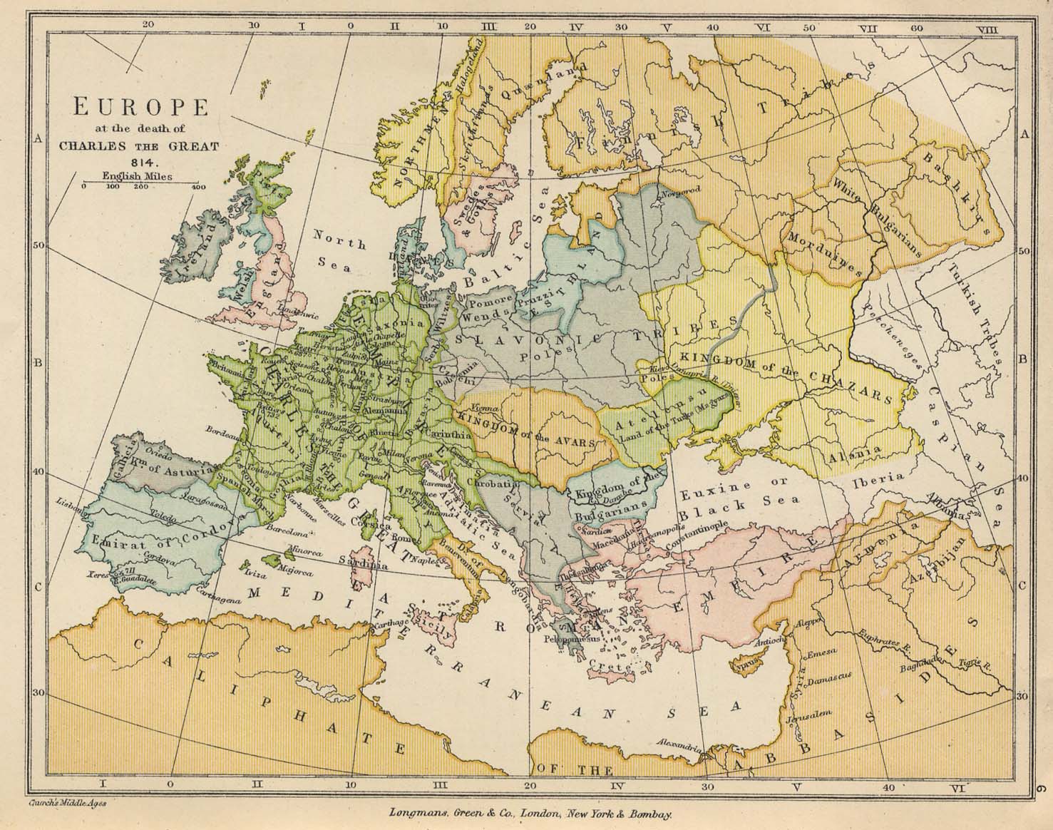
Πηγή : www.lib.utexas.edu/maps/historical/europe_814_colbeck.jpg Large JPEG (234K) from The Public Schools Historical Atlas, edited by C. Colbeck, published by Longmans, Green, and Co. 1905, made available online at the Perry-Castañeda Library, UT Austin.(netschoolbook.gr)

Πηγή://www.pitt.edu/~medart/image/france/france-l-to-z/mapsfrance/sf053fra.jpg :949k – Shepherd, p. 53 (netschoolbook.gr)
Αφήστε μια απάντηση
Για να σχολιάσετε πρέπει να συνδεθείτε.